File:Radio map of ice on Mercury.jpg
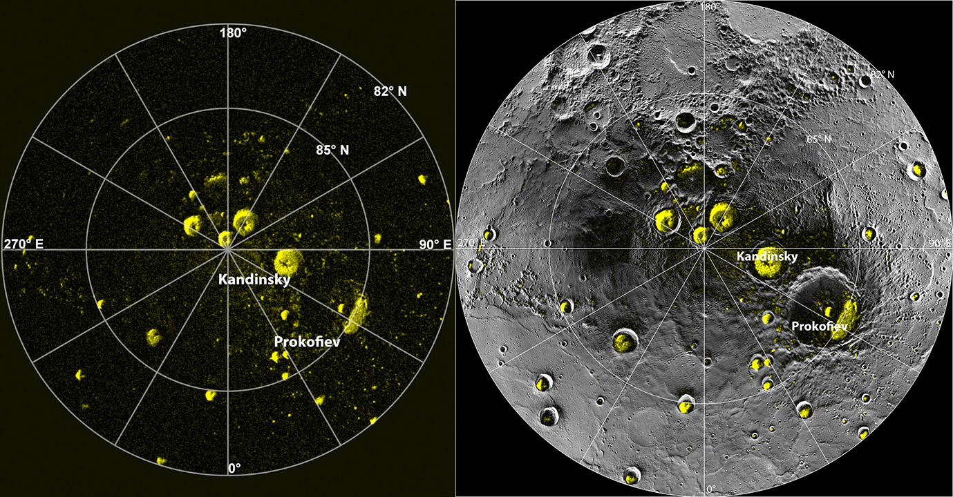
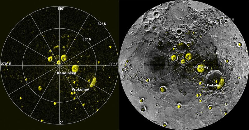
Revision as of 09:25, 11 January 2017 by Karthikeyan KC talk | contributions The picture on the left is the radar image of Mercury's north pole mapped from the Arecibo Observatory. The yellow regions are believed to be ice, showing high radar reflectivity. The picture on the right has the left radar image superimposed on the mo...
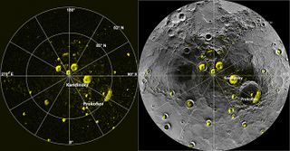
Size of this preview: 800 × 418 pixels. Other resolutions: 320 × 167 pixels | 1,379 × 720 pixels.
Original file 1,379 × 720 pixels, file size: 502 KB, MIME type: image/jpeg
Summaryedit
The picture on the left is the radar image of Mercury's north pole mapped from the Arecibo Observatory. The yellow regions are believed to be ice, showing high radar reflectivity. The picture on the right has the left radar image superimposed on the mosaic of images of the north pole from the MESSENGER spacecraft. It clearly shows that the radar reflectivity is high in the craters that are permanently shaded from the Sun.
Licensingedit
This work is dedicated to the public domain.
The person who associated a work with this deed has dedicated the work to the public domain by waiving all of his or her rights to the work worldwide under copyright law, including all related and neighboring rights, to the extent allowed by law. You can copy, modify, distribute and perform the work, even for commercial purposes, all without asking permission.
File history
Click on a date/time to view the file as it appeared at that time.
| Date/Time | Thumbnail | Dimensions | User | Comment | |
|---|---|---|---|---|---|
| current | 09:25, 11 January 2017 | | 1,379 × 720 502 KB | Karthikeyan KC talk | contributions | The picture on the left is the radar image of Mercury's north pole mapped from the Arecibo Observatory. The yellow regions are believed to be ice, showing high radar reflectivity. The picture on the right has the left radar image superimposed on the mo... |
- You cannot overwrite this file.
File usage
The following page links to this file: